


Latest Video
News
-

Meteo Curacao uploaded a video (7/5/2024)
Meteorological Department Curaçao
-
Meteo Curacao uploaded a video (7/1/2024)
Beryl Yuli 2024
-

-
Meteo Curacao uploaded a video (5/13/2024)
Meteorological Department Curaçao
-
Meteo Curacao uploaded a video (11/20/2023)
Boletin semanal 20 Nov te ku 26 Nov 2023
Weather Warning
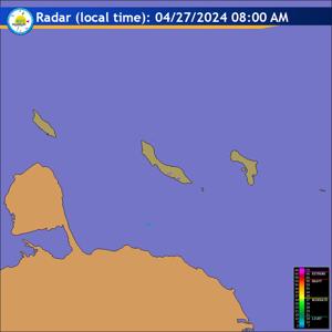
Radar
Satellite (InfraRed)

Forecast
Weather Forecast for Curaçao and surroundings valid until Monday midday 12:00
l.t., August 3, 2026.
Issued:
Sunday August 2, 2026, 11:00 l.t. (15:00 UTC).
Weather:
Partly cloudy to clear skies with predominantly dry conditions
prevailing. Temperatures will feel somewhat warm.
Forecast high will be 33ºC and the low will be 27ºC.
Sunrise will occur at 06:23 and sunset at 19:01.
Winds:
Easterly, at times shifting to the southeast and moderate to fresh; force
4 to 5 (20 to 39 km/h, 11 to 21 knots). Occasionally strong in gusts; force 6
(40 to 50 km/h, 22 to 27 knots).
Synopsis:
A dry and stable airmass will continue to dominate the region
throughout the day, maintaining predominantly fair skies. dry and slightly warm
conditions. A weak trough situated near the Windward Islands is expected to move
gradually westward into the region, introducing a gradual increase in moisture.
Despite this, wind shear will limit significant cloud development, preventing
any shower activity. As a result, the night is forecast to remain mostly dry
with only a few cloud patches.
Sea conditions:
Moderate with wave heights of 1.5 to 2 meters (4 to 7 feet). The
highest waves are expected over the southern coastal sections and northern open
sea. Seafarers are advised to navigate with caution and swimmers are advised to
remain vigilant and not venture too far from the coast.
Significant tropical weather systems:
None.
Special features:
None.
Outlook until Tuesday midday:
Variably cloudy, ranging from partly to mostly
cloudy. A few isolated showers may develop during the morning on Tuesday, though
most areas should remain generally dry.
Forecaster:
Kasmani.
The next weather forecast will be issued on Sunday 17:00 l.t. (21:00 UTC).