
Latest Video
News
-

Meteo Curacao uploaded a video (7/5/2024)
Meteorological Department Curaçao
-
Meteo Curacao uploaded a video (7/1/2024)
Beryl Yuli 2024
-

-
Meteo Curacao uploaded a video (5/13/2024)
Meteorological Department Curaçao
-
Meteo Curacao uploaded a video (11/20/2023)
Boletin semanal 20 Nov te ku 26 Nov 2023
Weather Warning
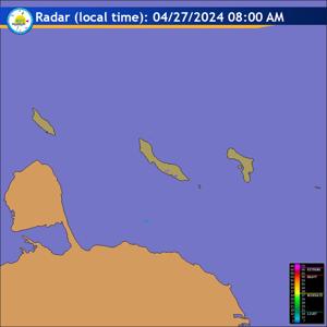
Radar
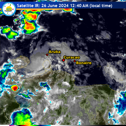
Satellite (InfraRed)
Forecast
Weather Forecast for Curaçao and surroundings valid until Friday evening 18:00
l.t., November 22, 2024.
Issued:
Thursday November 21 2024, 17:50 l.t. 21:50 UTC).
Weather:
Partly cloudy to clear sky and this evening and night with an overall
dry condition. Tomorrow, locally cloudy with a a couple of showers.
Forecast high will be 31ºC, and the low will be 26ºC.
Sunrise will occur at 06:37 and sunset at 18:07.
Winds:
Predominantly east and a generally light breeze; force 1 to 3 (1 to 19
km/h, 1 to 10 knots). Becoming lighter and variable at times or calm.
Synopsis:
Light easterly winds are foreseen to prevail over the area of our
island through the next day or so. These light winds will likely couple with an
atmospheric environment that favors daytime cloud formation and lead to some
afternoon showers and possible thunderstorms in this forecast period. Heavier
showers will sometimes cause street flooding in the usual prone areas.
Sea conditions:
Slight in general with wave heights of around 1 meter (3 feet).
Light swells will continue along the northern near offshore water.
Significant tropical weather systems:
None.
Special features:
None.
Outlook until Saturday evening:
Partly cloudy, at times mostly cloudy with
shower activity and possibly local thunderstorm.
Forecaster:
Coffie
The next weather forecast will be issued on Friday at 05:00 l.t. (09:00 UTC).